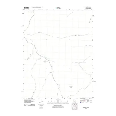
2011 Map of Dragon
USGS Topo · Published 2011About this map
Dragon serves as the focal point of this arid landscape, where the confluence of several deep drainages meets the primary transport corridor. The area's industrial character is defined by the Evacuation Creek Gas Field, illustrating the ongoing extraction economy of eastern Utah. Winding through the high desert, Evacuation Creek follows a course flanked by prominent geological features like White Face Butte and Rector Ridge. The terrain is deeply incised, with Dragon Canyon and Atchee Canyon providing natural passage through the elevated plateau. A network of local infrastructure, including Missouri Creek Rd and 3 Mile Rd, connects these isolated industrial sites to the wider region. High points such as Rabbit Mountain and Park Mountain overlook the drainage systems of Missouri Creek and Texas Creek, marking a landscape where topography dictates the patterns of human activity and resource development.
Find a feature on this map
18 named features on this map. Tap any name to fly to it.
Don’t see what you’re looking for? This feature index may not catch every label — zoom into the map to look around manually.
Map Details
Editions of this 2011 Dragon Map
This is the sole edition of this map. No revisions or reprints were ever made.
Other maps of this area

1885 · East Tavaputs
USGS Topo · 1:250,000

1956 · Grand Junction
USGS Topo · 1:250,000

1959 · Grand Junction
USGS Topo · 1:250,000

1960 · Grand Junction
USGS Topo · 1:250,000

1962 · Grand Junction
USGS Topo · 1:250,000

1964 · Grand Junction
USGS Topo · 1:250,000

1964 · Texas Creek
USGS Topo · 1:24,000

1964 · East Evacuation Creek
USGS Topo · 1:24,000
1964 · Banta Ridge
USGS Topo · 1:24,000

1965 · Grand Junction
USGS Topo · 1:250,000