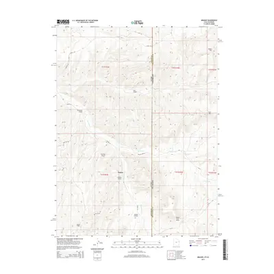
2014 Map of Dragon
USGS Topo · Published 2014About this map
Dragon lies at the intersection of high desert plateaus and deeply carved drainages along the border of Utah and Colorado. This 2014 survey captures the remote landscape of the Uintah Basin, where the industrial presence of the Evacuation Creek Gas Field is situated among ancient geological formations. The terrain is defined by prominent elevations such as Rabbit Mtn and White Face Butte, which tower over the intricate network of canyons including Dragon Canyon and Atchee Canyon.
Find a feature on this map
27 named features on this map. Tap any name to fly to it.
Don’t see what you’re looking for? This feature index may not catch every label — zoom into the map to look around manually.
Map Details
Editions of this 2014 Dragon Map
This is the sole edition of this map. No revisions or reprints were ever made.
Other maps of this area

1885 · East Tavaputs
USGS Topo · 1:250,000

1956 · Grand Junction
USGS Topo · 1:250,000

1959 · Grand Junction
USGS Topo · 1:250,000

1960 · Grand Junction
USGS Topo · 1:250,000

1962 · Grand Junction
USGS Topo · 1:250,000

1964 · Grand Junction
USGS Topo · 1:250,000

1964 · Texas Creek
USGS Topo · 1:24,000

1964 · East Evacuation Creek
USGS Topo · 1:24,000
1964 · Banta Ridge
USGS Topo · 1:24,000

1965 · Grand Junction
USGS Topo · 1:250,000