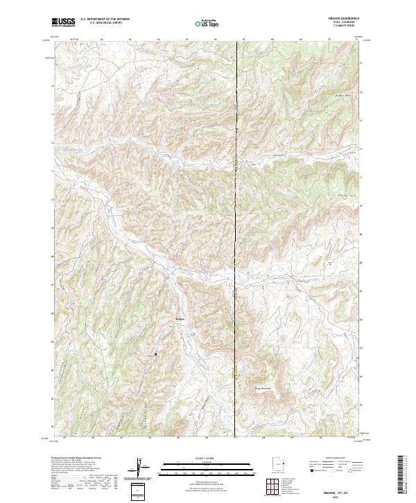
2023 Map of Dragon
USGS Topo · Published 2023About this map
The settlement of Dragon occupies a narrow corridor in the high desert along the Utah-Colorado border, serving as a focal point for this 2023 survey of the eastern Uintah Basin. The landscape is defined by a series of steep drainages and prominent ridges, including Rector Ridge and Atchee Ridge, which channel seasonal water through Evacuation Creek and Missouri Creek. Genealogists and local historians will find the Dragon Cem located just south of the main settlement area, providing a primary point of reference for the former mining community. The terrain rises sharply toward the northeast corner of the sheet at Rabbit Mtn, while the southern reaches are marked by the distinct White Face Butte. Access to the interior is limited to a few named routes like Dragon Rd and Country Boy Rd, reflecting the sparse, utilitarian road network of this borderland region.
Find a feature on this map
23 named features on this map. Tap any name to fly to it.
Don’t see what you’re looking for? This feature index may not catch every label — zoom into the map to look around manually.
Map Details
Editions of this 2023 Dragon Map
This is the sole edition of this map. No revisions or reprints were ever made.
Other maps of this area

1885 · East Tavaputs
USGS Topo · 1:250,000

1956 · Grand Junction
USGS Topo · 1:250,000

1959 · Grand Junction
USGS Topo · 1:250,000

1960 · Grand Junction
USGS Topo · 1:250,000

1962 · Grand Junction
USGS Topo · 1:250,000

1964 · Grand Junction
USGS Topo · 1:250,000

1964 · Texas Creek
USGS Topo · 1:24,000

1964 · East Evacuation Creek
USGS Topo · 1:24,000
1964 · Banta Ridge
USGS Topo · 1:24,000

1965 · Grand Junction
USGS Topo · 1:250,000