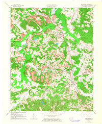
1963 Map of Drakesboro
USGS Topo · Published 1965About this map
Drakesboro and surrounding Muhlenberg County settlements are defined by an intensive coal extraction economy in the early 1960s. The landscape is heavily marked by extensive Strip Mines and numerous Tipple sites, illustrating the industrial footprint of the era. This industrial activity is tightly integrated with a transportation network dominated by the Louisville and Nashville and Illinois Central railroads, which weave through the hilly terrain to serve the various mines.
Find a feature on this map
35 named features on this map. Tap any name to fly to it.
Don’t see what you’re looking for? This feature index may not catch every label — zoom into the map to look around manually.
Map Details
Editions of this 1963 Drakesboro Map
3 editions found
Other maps of this area

1909 · Hartford
USGS Topo · 1:62,500

1909 · Central City
USGS Topo · 1:62,500

1911 · Drakesboro
USGS Topo · 1:48,000

1911 · Dunmor
USGS Topo · 1:48,000

1913 · Drakesboro
USGS Topo · 1:62,500

1914 · Dunmor
USGS Topo · 1:62,500

1952 · Greenville
USGS Topo · 1:24,000

1953 · Drakesboro
USGS Topo · 1:24,000

1953 · Rosewood
USGS Topo · 1:24,000

1953 · Central City West
USGS Topo · 1:24,000