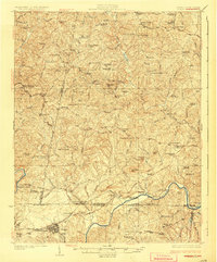
1926 Map of Draper
USGS Topo · Published 1926About this map
The Dan River serves as the focal point for this mid-1920s survey of the borderlands between Virginia and North Carolina, where the topography transitions from the foothills of Boyd Mountain and Glady Fork Mtn into the fertile river valley. This agrarian landscape is densely marked by the local infrastructure of the era, particularly the Danville and Western RR, which connects critical shipping points like Burnt Chimneys Sta, Cascade Station, and Oak Hill Sta Wenonda P O.
Find a feature on this map
92 named features on this map. Tap any name to fly to it.
Don’t see what you’re looking for? This feature index may not catch every label — zoom into the map to look around manually.
Map Details
Editions of this 1926 Draper Map
3 editions found

Other maps of this area

1921 · Chatham
USGS Topo · 1:48,000

1922 · Callands
USGS Topo · 1:48,000

1923 · Danville
USGS Topo · 1:48,000

1923 · Chatham
USGS Topo · 1:62,500

1924 · Martinsville
USGS Topo · 1:48,000

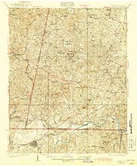
1924 · Draper
USGS Topo · 1:48,000

1924 · Callands
USGS Topo · 1:62,500

1925 · Rocky Mount
USGS Topo · 1:48,000

1925 · Danville
USGS Topo · 1:62,500

1926 · Martinsville
USGS Topo · 1:62,500