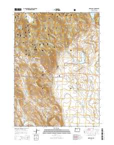
2014 Map of Drews Gap
USGS Topo · Published 2014About this map
Drews Gap and the Drews Gap Summit anchor this portion of the Fremont National Forest in Lake County. The landscape is defined by a sophisticated water management network designed for high-desert ranching and conservation, including the Clyde Fenimore Reservoir, Cottonwood Reservoir, and Junipers Reservoir. This area shows the intersection of transit and hydrology, where the Klamath Falls-Lakeview Hwy winds through Antelope Canyon alongside drainage systems like the Number Six Canal and E Canal. From the heights of Cub Cliff to the Willow Creek Hills, the terrain supports seasonal water sources such as Wooden Trough Spring and Patton Meadow, illustrating the critical role of water rights and storage in this corner of Oregon.
Find a feature on this map
39 named features on this map. Tap any name to fly to it.
Don’t see what you’re looking for? This feature index may not catch every label — zoom into the map to look around manually.
Map Details
Editions of this 2014 Drews Gap Map
This is the sole edition of this map. No revisions or reprints were ever made.
Other maps of this area

1955 · Klamath Falls
USGS Topo · 1:250,000

1958 · Klamath Falls
USGS Topo · 1:250,000

1964 · Drews Reservoir
USGS Topo · 1:24,000

1964 · Lakeview SW
USGS Topo · 1:24,000

1964 · Cox Flat
USGS Topo · 1:24,000

1964 · Lakeview NW
USGS Topo · 1:24,000
1964 · Dog Lake
USGS Topo · 1:24,000

1964 · Cougar Peak
USGS Topo · 1:24,000
1964 · Fitzwater Point
USGS Topo · 1:24,000

1964 · Drews Gap
USGS Topo · 1:24,000