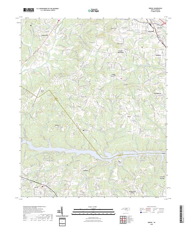
2022 Map of Drexel
USGS Topo · Published 2022About this map
Rhodhiss Lake and the Catawba River form a natural boundary between Caldwell and Burke counties, defining the residential and industrial character of this Piedmont landscape. This 2022 survey documents the established communities of Drexel, Valdese, and Rutherford College south of the river, while the northern uplands rise toward Bradford Mtn and Cajahs Mountain. The transport network is anchored by Morganton Blvd SW and the Foothills Regional Airport, facilitating local industry in towns like Sawmills and Hudson.
Find a feature on this map
43 named features on this map. Tap any name to fly to it.
Don’t see what you’re looking for? This feature index may not catch every label — zoom into the map to look around manually.
Map Details
Editions of this 2022 Drexel Map
This is the sole edition of this map. No revisions or reprints were ever made.