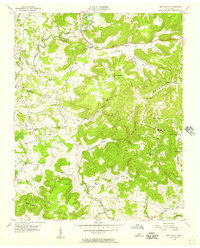
1956 Map of Dry Valley
USGS Topo · Published 1957About this map
The Falling Water River and the high ridges of Burnett Mountain define the rugged topography of this mid-century survey along the border of Putnam and White counties. The landscape is characterized by its numerous coves and deep depressions, most notably the Big Sink and Dry Valley, which illustrate the region's complex karst drainage. Small rural communities like Goffton and Key are shown connected by winding mountain roads, while the educational and spiritual life of the area is well-documented through scattered landmarks such as Stone Seminary, Bohannon Sch, and Robinson Chapel.
Find a feature on this map
40 named features on this map. Tap any name to fly to it.
Don’t see what you’re looking for? This feature index may not catch every label — zoom into the map to look around manually.
Map Details
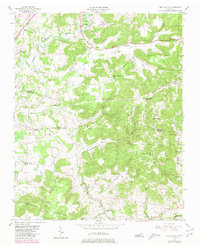
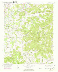
Editions of this 1956 Dry Valley Map
3 editions found
Other maps of this area

1892 · Pikeville
USGS Topo · 1:125,000

1893 · Mc Minnville
USGS Topo · 1:125,000

1895 · Mc Minnville
USGS Topo · 1:125,000

1895 · Pikeville
USGS Topo · 1:125,000

1897 · Standingstone
USGS Topo · 1:125,000

1898 · Standingstone
USGS Topo · 1:125,000

1943 · Cookeville
USGS Topo · 1:100,000

1944 · Cookeville
USGS Topo · 1:100,000

1953 · Chattanooga
USGS Topo · 1:250,000
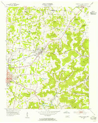
1953 · Cookeville East
USGS Topo · 1:24,000