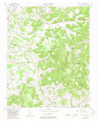
1956 Map of Dry Valley
USGS Topo · Published 1980About this map
The Putnam Co White Co border runs through this mid-century landscape, where narrow valleys and prominent ridges dictate the pattern of rural settlement. The northern reaches are defined by the Falling Water River and the waters of City Lake, while the central and southern terrain is dominated by the steep slopes of Phifer Mountain, Burnett Mountain, and Goulden Mountain. This topography funnels community life into lowland areas like DRY Valley and Board Valley.
Find a feature on this map
39 named features on this map. Tap any name to fly to it.
Don’t see what you’re looking for? This feature index may not catch every label — zoom into the map to look around manually.
Map Details
Editions of this 1956 Dry Valley Map
3 editions found
Other maps of this area

1892 · Pikeville
USGS Topo · 1:125,000

1893 · Mc Minnville
USGS Topo · 1:125,000

1895 · Mc Minnville
USGS Topo · 1:125,000

1895 · Pikeville
USGS Topo · 1:125,000

1897 · Standingstone
USGS Topo · 1:125,000

1898 · Standingstone
USGS Topo · 1:125,000

1943 · Cookeville
USGS Topo · 1:100,000

1944 · Cookeville
USGS Topo · 1:100,000

1953 · Chattanooga
USGS Topo · 1:250,000

1953 · Cookeville East
USGS Topo · 1:24,000