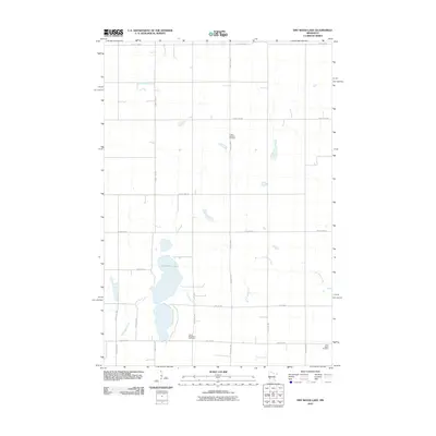
2010 Map of Dry Wood Lake
USGS Topo · Published 2010About this map
Dry Wood Lake serves as the central focal point of this agricultural prairie landscape in Stevens County. The surrounding terrain is defined by a rhythmic grid of rural routes, including County Hwy-9 and County Hwy-5, which facilitate movement through the extensive farmland. Three distinct burial grounds—Trinity Lutheran Cemetery in the north, Good Shepherd Cemetery near the center, and Saint Agnes Cemetery in the southeast—anchor the local geography and provide vital points of interest for genealogists tracing family roots in this corner of Minnesota. The drainage of the land is managed by the winding paths of Dry Wood Creek and Artichoke Creek, which cut across the structured section lines of the township grid.
Find a feature on this map
24 named features on this map. Tap any name to fly to it.
Don’t see what you’re looking for? This feature index may not catch every label — zoom into the map to look around manually.
Map Details
Editions of this 2010 Dry Wood Lake Map
This is the sole edition of this map. No revisions or reprints were ever made.
Other maps of this area

1910 · Chokio
USGS Topo · 1:62,500

1912 · Chokio
USGS Topo · 1:62,500

1912 · Morris
USGS Topo · 1:62,500

1953 · Milbank
USGS Topo · 1:250,000

1953 · Saint Cloud
USGS Topo · 1:250,000

1957 · Saint Cloud
USGS Topo · 1:250,000

1958 · Milbank
USGS Topo · 1:250,000

1958 · Saint Cloud
USGS Topo · 1:250,000

1968 · Dry Wood Lake
USGS Topo · 1:24,000

1968 · Lake Oliver
USGS Topo · 1:24,000