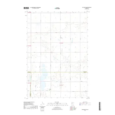
2019 Map of Dry Wood Lake
USGS Topo · Published 2019About this map
Dry Wood Lake and its surrounding wetlands dominate the landscape where Stevens, Big Stone, and Swift Counties converge. This 2019 survey captures a rural Minnesota terrain defined by its water systems and the meticulous grid of the Public Land Survey System. The prairie landscape is drained by Dry Wood Cr and Artichoke Cr, with the latter winding through the southwestern corner of the quadrangle. Local history is anchored by several rural burial sites, including the Trinity Lutheran Cem and Good Shepherd Cem, which reflect the area's established farming communities. The road network, including Co HWY 4 and Co HWY 9, illustrates the modern connectivity required for this agricultural heartland while maintaining the traditional section lines established over a century ago.
Find a feature on this map
43 named features on this map. Tap any name to fly to it.
Don’t see what you’re looking for? This feature index may not catch every label — zoom into the map to look around manually.
Map Details
Editions of this 2019 Dry Wood Lake Map
This is the sole edition of this map. No revisions or reprints were ever made.
Other maps of this area

1910 · Chokio
USGS Topo · 1:62,500

1912 · Chokio
USGS Topo · 1:62,500

1912 · Morris
USGS Topo · 1:62,500

1953 · Milbank
USGS Topo · 1:250,000

1953 · Saint Cloud
USGS Topo · 1:250,000

1957 · Saint Cloud
USGS Topo · 1:250,000

1958 · Milbank
USGS Topo · 1:250,000

1958 · Saint Cloud
USGS Topo · 1:250,000

1968 · Dry Wood Lake
USGS Topo · 1:24,000

1968 · Lake Oliver
USGS Topo · 1:24,000