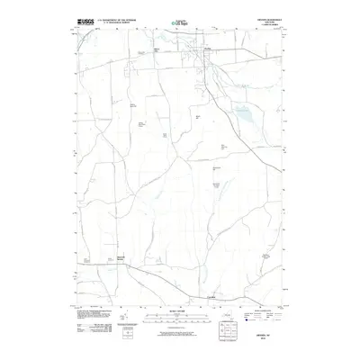
2010 Map of Dryden
USGS Topo · Published 2010About this map
Dryden serves as the primary hub in this area of Tompkins County, where the topography is defined by significant elevations and a network of tributary waters. The landscape transition is evident from the northern reaches around Willow Glen and Egypt Creek to the southern elevations of Star Stanton Hill and Hammond Hill. Conservation is a dominant theme of the geography, with large tracts dedicated to the Yellow Barn State Forest, Hammond Hill State Forest, and Robinson Hollow State Forest in the east. Genealogy researchers will find several well-defined burial grounds, including Willow Glen Cemetery and the Dutch Reformed Cemetery near Slaterville Springs. The hydrology is complex, with Sixmile Creek and the West Branch Owego Creek draining the southern slopes, while Dryden Lake remains a prominent local landmark near the eastern border.
Find a feature on this map
64 named features on this map. Tap any name to fly to it.
Don’t see what you’re looking for? This feature index may not catch every label — zoom into the map to look around manually.
Map Details
Editions of this 2010 Dryden Map
This is the sole edition of this map. No revisions or reprints were ever made.
Other maps of this area

1898 · Moravia
USGS Topo · 1:62,500

1900 · Dryden
USGS Topo · 1:62,500

1902 · Moravia
USGS Topo · 1:62,500

1903 · Cortland
USGS Topo · 1:62,500

1903 · Harford
USGS Topo · 1:62,500

1906 · Catatonk
USGS Topo · 1:125,000

1942 · Groton
USGS Topo · 1:24,000

1943 · West Groton
USGS Topo · 1:31,680

1943 · Groton
USGS Topo · 1:31,680

1944 · Cortland
USGS Topo · 1:31,680