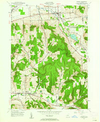
1949 Map of Dryden
USGS Topo · Published 1962About this map
The village of Dryden serves as the focal point of this 1949 survey, situated at the junction of the Lehigh Valley Railroad and the upper reaches of Fall Creek. The landscape transitions from the broad valleys in the north to the significant elevations of Yellow Barn Hill and Star Stanton Hill further south. Genealogists and local historians will find significant detail in the numerous family-linked landmarks and burial grounds, including the Willow Glen Cem, Mulks Cem, and the Dutch Reformed Cem near West Slaterville.
Find a feature on this map
40 named features on this map. Tap any name to fly to it.
Don’t see what you’re looking for? This feature index may not catch every label — zoom into the map to look around manually.
Map Details
Editions of this 1949 Dryden Map
This is the sole edition of this map. No revisions or reprints were ever made.
Other maps of this area

1898 · Moravia
USGS Topo · 1:62,500

1900 · Dryden
USGS Topo · 1:62,500

1902 · Moravia
USGS Topo · 1:62,500

1903 · Cortland
USGS Topo · 1:62,500

1903 · Harford
USGS Topo · 1:62,500

1906 · Catatonk
USGS Topo · 1:125,000

1942 · Groton
USGS Topo · 1:24,000

1943 · West Groton
USGS Topo · 1:31,680

1943 · Groton
USGS Topo · 1:31,680

1944 · Cortland
USGS Topo · 1:31,680