
1922 Map of Du Bois
USGS Topo · Published 1957About this map
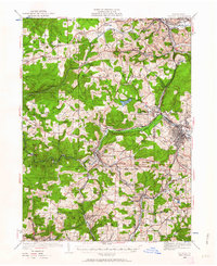
Industrial activity and rural settlement define this landscape in the early twentieth century, where the Jefferson Co Clearfield Co line runs through a network of active rail corridors and mining hubs. The city of Du Bois and the borough of Reynoldsville serve as primary anchors, linked by the Pennsylvania and Buffalo Rochester and Pittsburgh lines. The map reveals a dense distribution of rural education centers, including the Groves School and McAninch School, serving scattered communities like Sugar Hill and Emerickville. The resource-driven economy of the era is evident at the Eleanora Mines and Coal Glen, while the B Brand Reservoir and numerous runs, such as Sandy Lick Creek, show the vital water infrastructure supporting both the towns and the surrounding industry.
Find a feature on this map
121 named features on this map. Tap any name to fly to it.
Don’t see what you’re looking for? This feature index may not catch every label — zoom into the map to look around manually.
Map Details
Editions of this 1922 Du Bois Map
2 editions found
Other maps of this area

1903 · Curwensville
USGS Topo · 1:62,500

1906 · Punxsutawney
USGS Topo · 1:62,500

1909 · Smicksburg
USGS Topo · 1:62,500

1918 · Loleta
USGS Topo · 1:62,500

1924 · Du Bois
USGS Topo · 1:62,500

1924 · Brookville
USGS Topo · 1:62,500

1926 · Brookville
USGS Topo · 1:62,500

1929 · Penfield
USGS Topo · 1:62,500

1932 · Penfield
USGS Topo · 1:62,500

1936 · Marienville
USGS Topo · 1:48,000