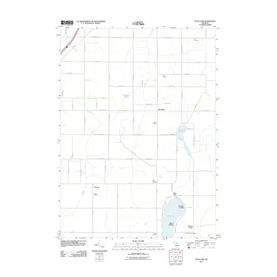
2011 Map of Duck Lake
USGS Topo · Published 2011About this map
Brookfield serves as a central point in this rural landscape, which is defined by its agricultural grid and a high concentration of established burial grounds. Researchers will find numerous sites of interest for genealogical study, including the Fox Cemetery, Perry Cemetery, and Sowles Cemetery. Further south, the landscape transitions from the straight lines of township roads like W Spicerville Hwy and E Nye Hwy to the irregular shoreline of Duck Lake. Along these waters, small landings such as Charlotte Landing and Albion Landing mark focal points for local recreation and lakeside settlement. The map also captures several smaller community hubs, from Partello in the southwest to Clarence Center at the southern edge, illustrating the dispersed but organized settlement pattern of this part of Michigan.
Find a feature on this map
68 named features on this map. Tap any name to fly to it.
Don’t see what you’re looking for? This feature index may not catch every label — zoom into the map to look around manually.
Map Details
Editions of this 2011 Duck Lake Map
This is the sole edition of this map. No revisions or reprints were ever made.
Other maps of this area

1910 · Lansing
USGS Topo · 1:62,500

1912 · Lansing
USGS Topo · 1:62,500

1919 · Springport
USGS Topo · 1:62,500

1921 · Springport
USGS Topo · 1:62,500

1921 · Marshall
USGS Topo · 1:62,500

1923 · Marshall
USGS Topo · 1:62,500

1943 · Marshall
USGS Topo · 1:62,500

1949 · Charlotte
USGS Topo · 1:62,500

1958 · Grand Rapids
USGS Topo · 1:250,000

1961 · Grand Rapids
USGS Topo · 1:250,000