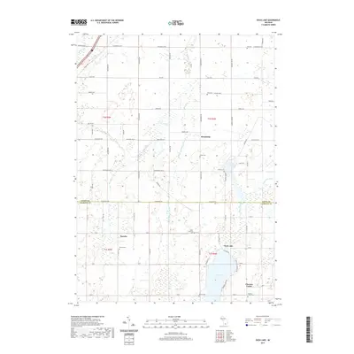
2019 Map of Duck Lake
USGS Topo · Published 2019About this map
Duck Lake and the surrounding township of Brookfield anchor this rural landscape along the boundary of Eaton and Calhoun counties. The area is defined by a complex network of agricultural drainage and natural waterways, including the Hogle and Miller Ditch, Battle Creek, and Devil Lake Ditch. Small crossroads settlements like Partello and Clarence Center reflect the enduring agricultural character of the region, while the presence of several family and community burial grounds, such as Sowles Cemetery and Nichols Cemetery, provides valuable markers for genealogical research.
Find a feature on this map
75 named features on this map. Tap any name to fly to it.
Don’t see what you’re looking for? This feature index may not catch every label — zoom into the map to look around manually.
Map Details
Editions of this 2019 Duck Lake Map
This is the sole edition of this map. No revisions or reprints were ever made.
Other maps of this area

1910 · Lansing
USGS Topo · 1:62,500

1912 · Lansing
USGS Topo · 1:62,500

1919 · Springport
USGS Topo · 1:62,500

1921 · Springport
USGS Topo · 1:62,500

1921 · Marshall
USGS Topo · 1:62,500

1923 · Marshall
USGS Topo · 1:62,500

1943 · Marshall
USGS Topo · 1:62,500

1949 · Charlotte
USGS Topo · 1:62,500

1958 · Grand Rapids
USGS Topo · 1:250,000

1961 · Grand Rapids
USGS Topo · 1:250,000