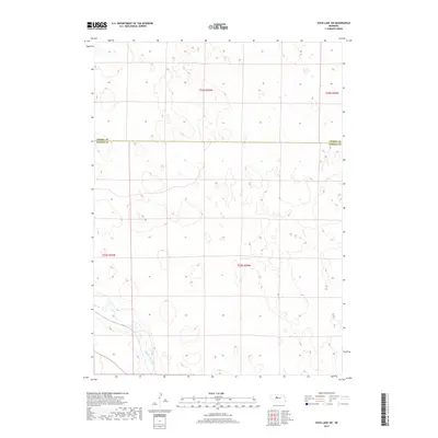
2017 Map of Duck Lake SW
USGS Topo · Published 2017About this map
Middle Loup River meanders through the southwestern corner of this survey, carving a path through the extensive sandhill topography of north-central Nebraska. This 2017 edition illustrates the sparse human development in the region, where the primary man-made features are the administrative boundary lines separating Cherry Co and Thomas Co. The landscape is defined by the natural hydrology and the Public Land Survey System grid, which includes segments of t24n r29w and t25n r29w. The map provides a clear look at the intricate dune formations and isolated wetlands that characterize this section of the Great Plains, capturing the area in a contemporary era where open ranch land and river systems remain the dominant geographic features.
Find a feature on this map
6 named features on this map. Tap any name to fly to it.
Don’t see what you’re looking for? This feature index may not catch every label — zoom into the map to look around manually.
Map Details
Editions of this 2017 Duck Lake SW Map
This is the sole edition of this map. No revisions or reprints were ever made.
Other maps of this area

1948 · Seneca
USGS Topo · 1:62,500

1948 · Thedford
USGS Topo · 1:62,500

1948 · Seneca 4
USGS Topo · 1:62,500

1949 · Seneca 4
USGS Topo · 1:62,500

1950 · Thedford
USGS Topo · 1:62,500

1950 · Shimmins Lake
USGS Topo · 1:62,500

1951 · Seneca
USGS Topo · 1:62,500

1954 · North Platte
USGS Topo · 1:250,000

1956 · North Platte
USGS Topo · 1:250,000

1957 · North Platte
USGS Topo · 1:250,000