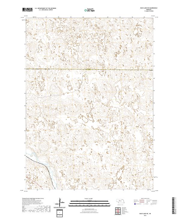
2021 Map of Duck Lake SW
USGS Topo · Published 2021About this map
Middle Loup River meanders through the southwestern corner of this Nebraska landscape, cutting across a terrain defined by the sweeping sandhills of the Great Plains. The boundary between Cherry Co and Thomas Co bisects the northern half of the region, marking a sparsely settled area where the landscape is largely shaped by natural hydrology and township divisions. The map highlights the vast, unpaved character of the Sandhills region in the early 21st century, illustrating the traditional section lines of the Public Land Survey System that govern this portion of the state. This survey serves as a clear record of the river's path and the administrative lines of T24n R29w and T25n R29w in a remote part of the Nebraska interior.
Find a feature on this map
6 named features on this map. Tap any name to fly to it.
Don’t see what you’re looking for? This feature index may not catch every label — zoom into the map to look around manually.
Map Details
Editions of this 2021 Duck Lake SW Map
This is the sole edition of this map. No revisions or reprints were ever made.
Other maps of this area

1948 · Seneca
USGS Topo · 1:62,500

1948 · Thedford
USGS Topo · 1:62,500

1948 · Seneca 4
USGS Topo · 1:62,500

1949 · Seneca 4
USGS Topo · 1:62,500

1950 · Thedford
USGS Topo · 1:62,500

1950 · Shimmins Lake
USGS Topo · 1:62,500

1951 · Seneca
USGS Topo · 1:62,500

1954 · North Platte
USGS Topo · 1:250,000

1956 · North Platte
USGS Topo · 1:250,000

1957 · North Platte
USGS Topo · 1:250,000