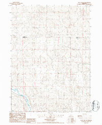
1986 Map of Duck Lake SW
USGS Topo · Published 1986About this map
The Middle Loup River winds through the southwestern corner of this Sandhills landscape, marking the primary drainage for an area defined by its rolling topography and sparse infrastructure. Surveyed in the mid-1980s, the map highlights the boundary between Cherry Co and Thomas Co, showing how political lines bisect this remote cattle country. Beyond the river valley, the terrain is dotted with isolated indicators of ranching life, such as a solitary Well, reflecting the reliance on groundwater in this arid Nebraska environment. The absence of established towns or major roads emphasizes the region's character as a working rangeland, where the natural contours of the hills dictate the path of unimproved trails and property lines.
Find a feature on this map
3 named features on this map. Tap any name to fly to it.
Don’t see what you’re looking for? This feature index may not catch every label — zoom into the map to look around manually.
Map Details
Editions of this 1986 Duck Lake SW Map
This is the sole edition of this map. No revisions or reprints were ever made.
Other maps of this area

1948 · Seneca
USGS Topo · 1:62,500

1948 · Thedford
USGS Topo · 1:62,500

1948 · Seneca 4
USGS Topo · 1:62,500

1949 · Seneca 4
USGS Topo · 1:62,500

1950 · Thedford
USGS Topo · 1:62,500

1950 · Shimmins Lake
USGS Topo · 1:62,500

1951 · Seneca
USGS Topo · 1:62,500

1954 · North Platte
USGS Topo · 1:250,000

1956 · North Platte
USGS Topo · 1:250,000

1957 · North Platte
USGS Topo · 1:250,000