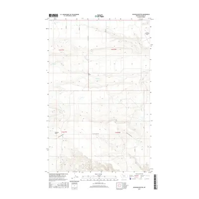
2017 Map of Duckhead Buttes
USGS Topo · Published 2017About this map
Duckhead Buttes and the winding course of Spring Cr define this landscape in Glacier County, where the high plains meet traditional ranching and transportation corridors. The map reflects a region shaped by large-scale land management and infrastructure, anchored in the northeast by the Cut Bank International Airport. A grid of rural routes, including Sather Rd, Miller Rd, and Shady Grove Rd, provides access across the townships. One of the more notable thoroughfares is Gov Hugo Aronson Rd, named for the local homesteading figure and former Montana governor, Hugo Aronson, known as 'The Galloping Swede.' This terrain of coulees and high plateaus, such as Flat Coulee, highlights the sparse but purposeful settlement pattern typical of the Montana plains in the early 21st century.
Find a feature on this map
15 named features on this map. Tap any name to fly to it.
Don’t see what you’re looking for? This feature index may not catch every label — zoom into the map to look around manually.
Map Details
Editions of this 2017 Duckhead Buttes Map
This is the sole edition of this map. No revisions or reprints were ever made.
Other maps of this area

1907 · Blackfoot Res.
USGS Topo · 1:48,000

1909 · Cut Bank
USGS Topo · 1:125,000

1911 · Blackfoot
USGS Topo · 1:125,000

1912 · Cut Bank
USGS Topo · 1:125,000

1914 · Heart Butte
USGS Topo · 1:125,000

1918 · Heart Butte
USGS Topo · 1:125,000

1920 · Dupuyer
USGS Topo · 1:125,000

1934 · Lake Frances
USGS Topo · 1:48,000

1937 · Lake Frances
USGS Topo · 1:62,500

1960 · Cut Bank
USGS Topo · 1:250,000