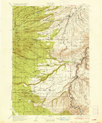
1934 Map of Dufur
USGS Topo · Published 1934About this map
Tygh Ridge and the Deschutes River canyon dominate the eastern landscape of Wasco County during the early 1930s. The agricultural economy of the region is evident in the numerous rural schools and lumber mills, such as Shellrock Sch and Westfall Mill, scattered across the plateau and foothills. To the west, the rugged drainage basins of Eightmile Creek and Fifteenmile Creek give way to the Warm Springs Indian Reservation and the high peaks of the Cascades.
Find a feature on this map
106 named features on this map. Tap any name to fly to it.
Don’t see what you’re looking for? This feature index may not catch every label — zoom into the map to look around manually.
Map Details
Editions of this 1934 Dufur Map
2 editions found
Other maps of this area

1924 · Mount Hood
USGS Topo · 1:125,000

1926 · Hood River
USGS Topo · 1:125,000

1927 · Mount Hood
USGS Topo · 1:125,000

1927 · Mt. Jefferson
USGS Topo · 1:125,000

1928 · Madras
USGS Topo · 1:125,000

1929 · Hood River
USGS Topo · 1:125,000

1930 · Mt. Jefferson
USGS Topo · 1:125,000

1930 · Dufur
USGS Topo · 1:125,000

1931 · Madras
USGS Topo · 1:125,000

1934 · Dufur
USGS Topo · 1:125,000