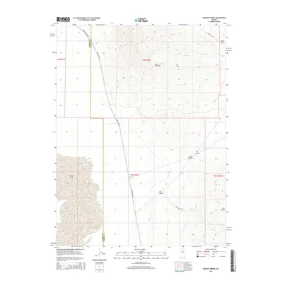
2014 Map of Dugout Spring
USGS Topo · Published 2014About this map
The Lander Co and Eureka Co line bisects this high-desert basin, where drainage routes and isolated water sources defined the movement of early ranchers and miners. The high peaks of the Cortez Mountains and the Dry Hills overlook a landscape carved by Cortez Canyon and Horse Canyon. This survey captures the connectivity of the Great Basin interior through established routes like Cortez Canyon Rd and Grass Valley Rd, which follow the natural contours of the land. Critical water points, including Rossi Spring and Dugout Spring, appear as vital landmarks in an otherwise arid expanse. In the lower elevations, the broad reaches of Grass Valley and Pine Valley are separated by the strategic passage at Garden Gate Pass, illustrating the geographic constraints on travel through this part of central Nevada.
Find a feature on this map
22 named features on this map. Tap any name to fly to it.
Don’t see what you’re looking for? This feature index may not catch every label — zoom into the map to look around manually.
Map Details
Editions of this 2014 Dugout Spring Map
This is the sole edition of this map. No revisions or reprints were ever made.
Other maps of this area

1926 · Roberts Mountains
USGS Topo · 1:250,000

1929 · Roberts Mountains
USGS Topo · 1:250,000

1938 · Cortez
USGS Topo · 1:48,000

1944 · Cortez
USGS Topo · 1:62,500

1949 · Roberts Creek Mtn
USGS Topo · 1:62,500

1951 · Roberts Creek Mtn
USGS Topo · 1:62,500

1955 · Millett
USGS Topo · 1:250,000

1955 · Winnemucca
USGS Topo · 1:250,000

1956 · Walti Hot Springs
USGS Topo · 1:62,500

1957 · Horse Creek Valley
USGS Topo · 1:62,500