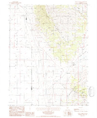
1986 Map of Dugout Spring
USGS Topo · Published 1986About this map
Cortez Mtns and the Simpson Park Mtns dominate this central Nevada landscape, separated by the high-elevation passage at Garden Gate Pass. This mid-1980s survey captures a region defined by its rugged topography and isolated outposts, where the Lander Co Eureka Co line bisects the arid terrain of Grass Valley and Pine Valley. Evidence of the area's resource-driven economy is clear from the numerous Prospects and Gravel Pit sites scattered across the Dry Hills. Water, the most critical resource for survival in the Alkali Flat surroundings, is represented by established points like Dugout Spring. The map also documents long-standing ranching operations such as Horse Ranch and Issacs Ranch, which sit near the mouths of Horse Canyon and Hog Canyon, marking where human habitation follows the natural drainage of the desert mountains.
Find a feature on this map
18 named features on this map. Tap any name to fly to it.
Don’t see what you’re looking for? This feature index may not catch every label — zoom into the map to look around manually.
Map Details
Editions of this 1986 Dugout Spring Map
This is the sole edition of this map. No revisions or reprints were ever made.
Other maps of this area

1926 · Roberts Mountains
USGS Topo · 1:250,000

1929 · Roberts Mountains
USGS Topo · 1:250,000

1938 · Cortez
USGS Topo · 1:48,000

1944 · Cortez
USGS Topo · 1:62,500

1949 · Roberts Creek Mtn
USGS Topo · 1:62,500

1951 · Roberts Creek Mtn
USGS Topo · 1:62,500

1955 · Millett
USGS Topo · 1:250,000

1955 · Winnemucca
USGS Topo · 1:250,000

1956 · Walti Hot Springs
USGS Topo · 1:62,500

1957 · Horse Creek Valley
USGS Topo · 1:62,500