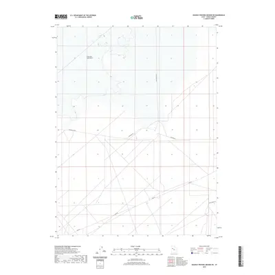
2020 Map of Dugway Proving Ground NE
USGS Topo · Published 2020About this map
Dugway Proving Ground occupies the southern portion of this landscape, characterized by the stark interface between military infrastructure and the vast Great Salt Lake Desert. This 2020 topographic survey reveals a strictly organized grid of access roads crossing the arid flats, including Stark Rd and Goodyear Rd. These routes facilitate movement across the basin floor, where subtle elevation contours delineate the ancient lakebed. The map illustrates the logistical footprint of the U.S. Army facility in Tooele County, with specific named transit corridors like N Wig Mountain Rd and Peter Charlie Rd providing navigation through the expansive desert terrain.
Find a feature on this map
7 named features on this map. Tap any name to fly to it.
Don’t see what you’re looking for? This feature index may not catch every label — zoom into the map to look around manually.
Map Details
Editions of this 2020 Dugway Proving Ground NE Map
This is the sole edition of this map. No revisions or reprints were ever made.
Other maps of this area

1885 · Tooele Valley
USGS Topo · 1:250,000

1953 · Tooele
USGS Topo · 1:250,000

1954 · Wig Mtn SW
USGS Topo · 1:24,000

1954 · Dugway Proving Ground SE
USGS Topo · 1:24,000

1954 · Dugway Proving Ground NE
USGS Topo · 1:24,000

1954 · Dugway Proving Ground SW
USGS Topo · 1:24,000

1954 · Camels Back Ridge NW
USGS Topo · 1:24,000

1954 · Dugway Proving Ground NW
USGS Topo · 1:24,000

1955 · Camels Back Ridge SW
USGS Topo · 1:24,000

1955 · Wig Mtn
USGS Topo · 1:24,000