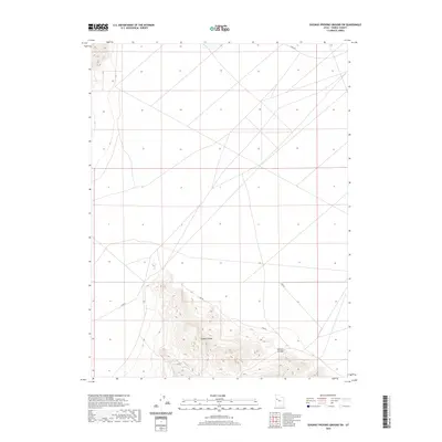
2020 Map of Dugway Proving Ground SW
USGS Topo · Published 2020About this map
Dugway Range dominates the southern landscape of this high-desert terrain within Tooele County. This modern survey illustrates a topography defined by significant elevation changes, particularly around Bullion Canyon, which cuts through the southern ridgelines. The northern portion of the map is characterized by the expansive, open flats typical of the Great Salt Lake Desert, where a network of straight-line tracks and roads, such as Stark Rd, indicates the area's specialized use within a military proving ground. The contrast between the dramatic relief of the range and the precise, geometric road network on the basin floor reflects the modern intersection of natural landforms and federal land management in the western United States.
Find a feature on this map
3 named features on this map. Tap any name to fly to it.
Don’t see what you’re looking for? This feature index may not catch every label — zoom into the map to look around manually.
Map Details
Editions of this 2020 Dugway Proving Ground SW Map
This is the sole edition of this map. No revisions or reprints were ever made.
Other maps of this area

1908 · Fish Springs
USGS Topo · 1:250,000

1910 · Fish Springs
USGS Topo · 1:250,000

1953 · Dugway Range NE
USGS Topo · 1:24,000

1953 · Dugway Range
USGS Topo · 1:62,500

1953 · Dugway Range NW
USGS Topo · 1:24,000

1953 · Tooele
USGS Topo · 1:250,000

1953 · Delta
USGS Topo · 1:250,000

1954 · Dugway Proving Ground SE
USGS Topo · 1:24,000

1954 · Dugway Proving Ground NE
USGS Topo · 1:24,000

1954 · Granite Peak
USGS Topo · 1:24,000