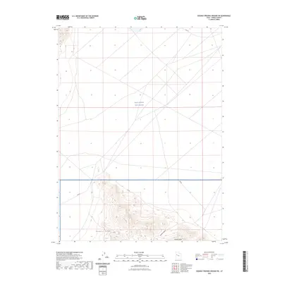
2023 Map of Dugway Proving Ground SW
USGS Topo · Published 2023About this map
The West Desert Test Center occupies the central expanse of this 2023 survey, representing a significant military footprint within the Tooele County desert. This landscape is defined by the stark contrast between the flat, geometric grid of the test range and the complex topography of the Dugway Range rising to the south. Along the southern edge of the quadrangle, geographical features such as Bullion Canyon and Hanauer Ridge break the desert floor, offering detail on the local relief and drainage patterns. Transportation through this controlled environment is limited to designated routes like Stark Rd and several numbered access roads including tc02791, tc02793, and tc02794, reflecting the area's specialized use as a government proving ground.
Find a feature on this map
8 named features on this map. Tap any name to fly to it.
Don’t see what you’re looking for? This feature index may not catch every label — zoom into the map to look around manually.
Map Details
Editions of this 2023 Dugway Proving Ground SW Map
This is the sole edition of this map. No revisions or reprints were ever made.
Other maps of this area

1908 · Fish Springs
USGS Topo · 1:250,000

1910 · Fish Springs
USGS Topo · 1:250,000

1953 · Dugway Range NE
USGS Topo · 1:24,000

1953 · Dugway Range
USGS Topo · 1:62,500

1953 · Dugway Range NW
USGS Topo · 1:24,000

1953 · Tooele
USGS Topo · 1:250,000

1953 · Delta
USGS Topo · 1:250,000

1954 · Dugway Proving Ground SE
USGS Topo · 1:24,000

1954 · Dugway Proving Ground NE
USGS Topo · 1:24,000

1954 · Granite Peak
USGS Topo · 1:24,000