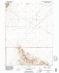
1993 Map of Dugway Proving Ground SW
USGS Topo · Published 1996About this map
The Dugway Range dominates the southern portion of this landscape, its steep topography rising abruptly from the surrounding desert flats. This area of Tooele County is defined by the expansive military reservation of the Dugway Proving Ground, where the sparse human imprint is largely restricted to infrastructure and resource extraction. Evidence of early prospecting is visible along the slopes of the range, where several Mine and Prospect sites are noted near Bullion Canyon, pointing to a history of mineral exploration in this arid environment.
Find a feature on this map
12 named features on this map. Tap any name to fly to it.
Don’t see what you’re looking for? This feature index may not catch every label — zoom into the map to look around manually.
Map Details
Editions of this 1993 Dugway Proving Ground SW Map
This is the sole edition of this map. No revisions or reprints were ever made.
Other maps of this area

1908 · Fish Springs
USGS Topo · 1:250,000

1910 · Fish Springs
USGS Topo · 1:250,000

1953 · Dugway Range NE
USGS Topo · 1:24,000

1953 · Dugway Range
USGS Topo · 1:62,500

1953 · Dugway Range NW
USGS Topo · 1:24,000

1953 · Tooele
USGS Topo · 1:250,000

1953 · Delta
USGS Topo · 1:250,000

1954 · Dugway Proving Ground SE
USGS Topo · 1:24,000

1954 · Dugway Proving Ground NE
USGS Topo · 1:24,000

1954 · Granite Peak
USGS Topo · 1:24,000