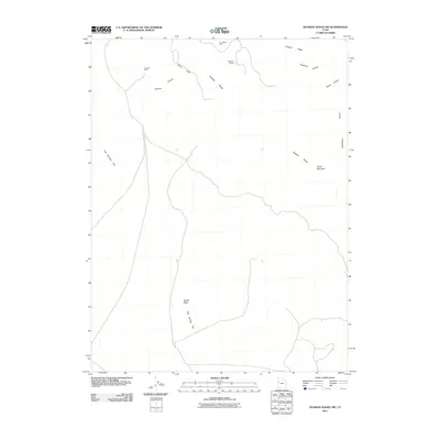
2011 Map of Dugway Range NW
USGS Topo · Published 2011About this map
Fish Springs Flat dominates the western expanse of this high-desert quadrangle, where the arid basin meets the western slopes of the Dugway Range. The landscape is defined by the legacy of early 21st-century mineral extraction and geological interest, evidenced by the presence of the Four Metal Mine and Rainbow Mines in the northern heights. To the south, the Geode Beds indicate a destination for collectors and geologists, marking a point of specific local interest within the vast public lands. The terrain transitions from the low-lying flat through steep ascents such as Castle Mountain and Hanauer Ridge. Numerous drainage patterns like Buckhorn Canyon and Gilson Canyon carve through the range, while the isolated Cannon Mine sits tucked within Cannon Canyon, illustrating the dispersed nature of mining activity in this corner of Tooele County.
Find a feature on this map
13 named features on this map. Tap any name to fly to it.
Don’t see what you’re looking for? This feature index may not catch every label — zoom into the map to look around manually.
Map Details
Editions of this 2011 Dugway Range NW Map
This is the sole edition of this map. No revisions or reprints were ever made.
Other maps of this area

1908 · Fish Springs
USGS Topo · 1:250,000

1910 · Fish Springs
USGS Topo · 1:250,000

1953 · Dugway Range NE
USGS Topo · 1:24,000

1953 · Dugway Pass
USGS Topo · 1:24,000

1953 · Dugway Range
USGS Topo · 1:62,500

1953 · Dugway Range NW
USGS Topo · 1:24,000

1953 · Tooele
USGS Topo · 1:250,000

1953 · Delta
USGS Topo · 1:250,000

1954 · Dugway Proving Ground SE
USGS Topo · 1:24,000

1954 · Dugway Proving Ground SW
USGS Topo · 1:24,000