
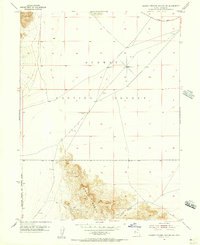
1953 Map of Dugway Range NW
USGS Topo · Published 1973About this map
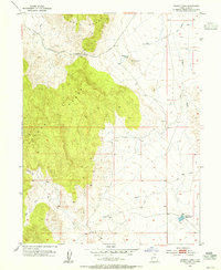
Rainbow Mines and the Four Metal Mine anchor the northern slopes of the Dugway Range in this 1953 survey, capturing the industrial footprint of the Tooele and Juab county border. The landscape is defined by its mining operations, with numerous Prospects, Shafts, and Tunnels scattered through the high elevations near Castle Mountain. Below these peaks, the terrain drops sharply into the expansive Fish Springs Flat, a stark contrast to the complex topography of Cannon Canyon and Buckhorn Canyon. Water sources are few and vital in this arid environment, evidenced by labels for Kellys Hole and Well No 28. The proximity of the Dugway Proving Ground to the north, noted in the margins, suggests the strategic and isolated nature of this section of the Great Salt Lake Desert during the early Cold War era.
Find a feature on this map
17 named features on this map. Tap any name to fly to it.
Don’t see what you’re looking for? This feature index may not catch every label — zoom into the map to look around manually.
Map Details
Editions of this 1953 Dugway Range NW Map
2 editions found
Other maps of this area

1908 · Fish Springs
USGS Topo · 1:250,000

1910 · Fish Springs
USGS Topo · 1:250,000

1953 · Dugway Range NE
USGS Topo · 1:24,000
1953 · Dugway Pass
USGS Topo · 1:24,000
1953 · Dugway Range
USGS Topo · 1:62,500
1953 · Dugway Range NW
USGS Topo · 1:24,000

1953 · Tooele
USGS Topo · 1:250,000

1953 · Delta
USGS Topo · 1:250,000
1954 · Dugway Proving Ground SE
USGS Topo · 1:24,000
1954 · Dugway Proving Ground SW
USGS Topo · 1:24,000