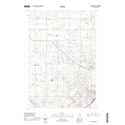
2019 Map of Duluth Heights
USGS Topo · Published 2019About this map
Duluth and its northwestern suburbs are defined by the rapid elevation gain from the shores of Lake Superior, a geography that shapes the commercial and residential corridors of Hermantown and Duluth Heights. The sprawling grounds of the Duluth International Airport dominate the northern plateau, while the descent toward the harbor is marked by steep ravines carved by Keene Cr and Miller Cr. This modern survey illustrates the dense concentration of cemeteries like Sunrise Memorial Cem and Jewish Cem along the ridges, reflecting the long-established communities that transitioned from rural townships to integrated urban districts. To the south, Proctor and Missabe Junction anchor the area's industrial legacy, where the land flattens toward the St. Louis River basin, while Lake Superior College sits perched above the city's western neighborhoods.
Find a feature on this map
106 named features on this map. Tap any name to fly to it.
Don’t see what you’re looking for? This feature index may not catch every label — zoom into the map to look around manually.
Map Details
Editions of this 2019 Duluth Heights Map
This is the sole edition of this map. No revisions or reprints were ever made.
Other maps of this area

1895 · Duluth
USGS Topo · 1:62,500

1915 · Superior
USGS Topo · 1:48,000

1917 · Superior
USGS Topo · 1:62,500

1953 · Twig
USGS Topo · 1:24,000

1953 · Adolph
USGS Topo · 1:24,000

1953 · Arnold
USGS Topo · 1:24,000

1953 · Duluth
USGS Topo · 1:24,000

1953 · Duluth Heights
USGS Topo · 1:24,000

1953 · Fredenberg
USGS Topo · 1:24,000

1953 · Duluth
USGS Topo · 1:62,500