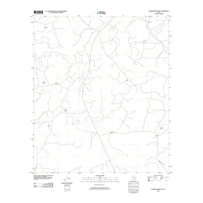
2010 Map of Dunbar Draw NW
USGS Topo · Published 2010About this map
Dry Devils River meanders through this portion of Sutton County, defining the drainage patterns of a landscape marked by expansive ranching operations. The area is characterized by a series of named topographic depressions, including Halbert Draw, Cauthorn Draw, and Cusenbary Draw, which channel seasonal runoff toward the primary riverbed. This 2010 survey highlights the traditional land-use patterns of the Texas Hill Country, where family-named properties like E Sawyer Ranch, C Shurley Ranch, and Reed Ranch serve as primary landmarks in an otherwise sparsely populated region. The network of local roads and unimproved tracks shown here provides insight into the connectivity between these remote homesteads and the drainage systems of Dunbar Draw, reflecting the essential relationship between water access and livestock management in this arid environment.
Find a feature on this map
11 named features on this map. Tap any name to fly to it.
Don’t see what you’re looking for? This feature index may not catch every label — zoom into the map to look around manually.
Map Details
Editions of this 2010 Dunbar Draw NW Map
This is the sole edition of this map. No revisions or reprints were ever made.
Other maps of this area

1954 · Sonora
USGS Topo · 1:250,000

1958 · Sonora
USGS Topo · 1:250,000

1964 · Sonora
USGS Topo · 1:24,000

1964 · Sonora SE
USGS Topo · 1:24,000

1967 · Dunbar Draw SW
USGS Topo · 1:24,000

1967 · Flat Rock Draw SE
USGS Topo · 1:24,000

1967 · Dunbar Draw NW
USGS Topo · 1:24,000

1967 · Dunbar Draw NE
USGS Topo · 1:24,000

1967 · Hudspeth Draw
USGS Topo · 1:24,000

1967 · Caverns Of Sonora
USGS Topo · 1:24,000