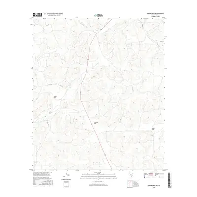
2016 Map of Dunbar Draw NW
USGS Topo · Published 2016About this map
Dry Devils River defines the drainage patterns across this Sutton County landscape, winding through a series of named draws that reveal the historic landholding patterns of the region. The map illustrates a network of drainage features including Halbert Draw, Cauthorn Draw, and Cusenbury Draw, names that often reflect the ranching families who established the area's early infrastructure. Transportation is primarily limited to secondary and private routes like Co RD 403 and SCR 406, which provide access to the high, segmented plateaus. In the east, Dunbar Draw cuts toward the southern edge of the quadrangle, highlighting the area's characteristic topographic relief and the importance of these seasonal watercourses in an arid environment.
Find a feature on this map
20 named features on this map. Tap any name to fly to it.
Don’t see what you’re looking for? This feature index may not catch every label — zoom into the map to look around manually.
Map Details
Editions of this 2016 Dunbar Draw NW Map
This is the sole edition of this map. No revisions or reprints were ever made.
Other maps of this area

1954 · Sonora
USGS Topo · 1:250,000

1958 · Sonora
USGS Topo · 1:250,000

1964 · Sonora
USGS Topo · 1:24,000

1964 · Sonora SE
USGS Topo · 1:24,000

1967 · Dunbar Draw SW
USGS Topo · 1:24,000

1967 · Flat Rock Draw SE
USGS Topo · 1:24,000

1967 · Dunbar Draw NW
USGS Topo · 1:24,000

1967 · Dunbar Draw NE
USGS Topo · 1:24,000

1967 · Hudspeth Draw
USGS Topo · 1:24,000

1967 · Caverns Of Sonora
USGS Topo · 1:24,000