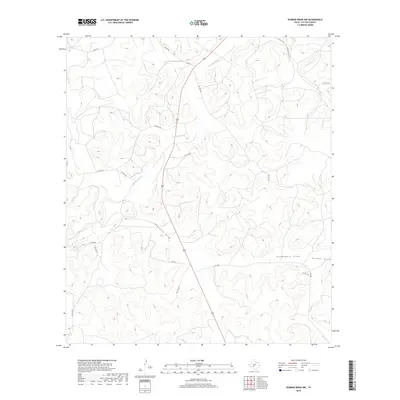
2019 Map of Dunbar Draw NW
USGS Topo · Published 2019About this map
The Dry Devils River meanders through the arid limestone terrain of Sutton County, defining the drainage patterns of this Edwards Plateau landscape. This high-plateau region is deeply dissected by numerous intermittent waterways, most notably Cauthorn Draw, Cusenbary Draw, and the eponymous Dunbar Draw in the southeast. These draws serve as the primary topographical markers in a landscape otherwise dominated by ranching infrastructure and a network of private and county roads. Transportation in this part of Texas is characterized by long, winding corridors such as Co Rd 403 and Co Rd 405, which follow the natural contours of the high ground between the drainage basins. The map illustrates a modern ranching economy where property access is facilitated by numerous private routes like Pvt Rd 4419 and Pvt Rd 4414, revealing the partitioned nature of large-scale landholdings in West Texas.
Find a feature on this map
19 named features on this map. Tap any name to fly to it.
Don’t see what you’re looking for? This feature index may not catch every label — zoom into the map to look around manually.
Map Details
Editions of this 2019 Dunbar Draw NW Map
This is the sole edition of this map. No revisions or reprints were ever made.
Other maps of this area

1954 · Sonora
USGS Topo · 1:250,000

1958 · Sonora
USGS Topo · 1:250,000

1964 · Sonora
USGS Topo · 1:24,000

1964 · Sonora SE
USGS Topo · 1:24,000

1967 · Dunbar Draw SW
USGS Topo · 1:24,000

1967 · Flat Rock Draw SE
USGS Topo · 1:24,000

1967 · Dunbar Draw NW
USGS Topo · 1:24,000

1967 · Dunbar Draw NE
USGS Topo · 1:24,000

1967 · Hudspeth Draw
USGS Topo · 1:24,000

1967 · Caverns Of Sonora
USGS Topo · 1:24,000