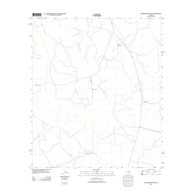
2012 Map of Dunbar Draw SW
USGS Topo · Published 2012About this map
The expansive ranchlands of Mack Cauthorn Ranch and Dan Cauthorn Ranch define this landscape in Val Verde County. Located in a region of Texas known for its large pastoral holdings, the map illustrates the distribution of family-named stations across the dry draws and ridges of the Edwards Plateau. Transportation through this rural corridor is facilitated by Ranch Road 189 and the restricted access of Private Road 4430. Other notable property markers include the J A Cauthorn Ranch and the Sam Allison Ranch, which serve as primary landmarks for orientation in this sparsely populated area. The layout of these ranches reflects the enduring legacy of 20th-century Texas land use, where infrastructure often follows the natural contours of the terrain.
Find a feature on this map
6 named features on this map. Tap any name to fly to it.
Don’t see what you’re looking for? This feature index may not catch every label — zoom into the map to look around manually.
Map Details
Editions of this 2012 Dunbar Draw SW Map
This is the sole edition of this map. No revisions or reprints were ever made.
Other maps of this area

1954 · Sonora
USGS Topo · 1:250,000

1958 · Sonora
USGS Topo · 1:250,000

1967 · Dunbar Draw SW
USGS Topo · 1:24,000

1967 · Flat Rock Draw SE
USGS Topo · 1:24,000

1967 · Dunbar Draw NW
USGS Topo · 1:24,000

1967 · Dunbar Draw NE
USGS Topo · 1:24,000

1967 · Hudspeth Draw
USGS Topo · 1:24,000

1967 · Dunbar Draw SE
USGS Topo · 1:24,000
1971 · Turney Draw NE
USGS Topo · 1:24,000

1973 · Turney Draw NW
USGS Topo · 1:24,000