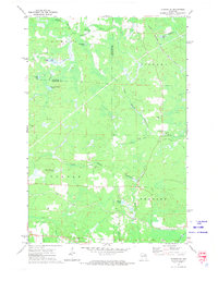
1972 Map of Dunbar NE
USGS Topo · Published 1974About this map
The North Branch Pemebonwon River and its southern counterpart dominate this northern Wisconsin landscape, converging in a region defined by complex drainage patterns and numerous small glacial lakes. Surveyed in the early 1970s, the map reveals a rural transition where the townships of Aurora, Niagara, Dunbar, and Pembine meet. Transportation infrastructure is a central theme, with the Chicago Milwaukee St Paul and Pacific railroad cutting through the northeast corner and the Soo Line traversing the southern portion near the settlement of Cole. Local land use is marked by several Gravel Pits and an established network of rural roads such as East Cataline Road. Significant landmarks like the Dunbar Lookout Tower and named water bodies including No Bottom Lake and Belgian Lake provide key reference points for local history and geographic study.
Find a feature on this map
27 named features on this map. Tap any name to fly to it.
Don’t see what you’re looking for? This feature index may not catch every label — zoom into the map to look around manually.
Map Details
Editions of this 1972 Dunbar NE Map
2 editions found
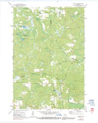
Other maps of this area

1939 · Pembine
USGS Topo · 1:48,000

1939 · Dunbar
USGS Topo · 1:48,000

1939 · Iron Mountain
USGS Topo · 1:48,000

1941 · Dunbar
USGS Topo · 1:48,000

1941 · Iron Mountain
USGS Topo · 1:48,000

1947 · Pembine
USGS Topo · 1:48,000

1947 · Dunbar
USGS Topo · 1:48,000

1947 · Iron Mountain
USGS Topo · 1:48,000

1954 · Iron Mountain
USGS Topo · 1:250,000

1954 · Escanaba
USGS Topo · 1:250,000