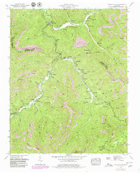
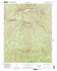
1952 Map of Duncan Flats
USGS Topo · Published 1980About this map
New River and its winding tributaries, including Beech Fork and Ligias Fork, dictate the settlement patterns of this mountain landscape. In the early 1950s, small communities like Stainville and Rosedale thrived along the valley floor, while numerous family-named landmarks like Phillips Cemetery, Asslinger Cemetery, and Bunch Cemetery reveal the deep-rooted genealogy of the region. Educational and spiritual life was centered at the Redoak Gap School and Grave Hill Church, though later revisions to the map indicate a shift toward industrial land use.
Find a feature on this map
100 named features on this map. Tap any name to fly to it.
Don’t see what you’re looking for? This feature index may not catch every label — zoom into the map to look around manually.
Map Details
Editions of this 1952 Duncan Flats Map
5 editions found
Other maps of this area

1893 · Briceville
USGS Topo · 1:125,000

1895 · Briceville
USGS Topo · 1:125,000

1896 · Briceville
USGS Topo · 1:125,000

1936 · Hogbell Gap
USGS Topo · 1:24,000

1936 · Block
USGS Topo · 1:24,000

1936 · Jacksboro
USGS Topo · 1:24,000

1936 · Duncan Flats
USGS Topo · 1:24,000

1936 · Windrock
USGS Topo · 1:24,000

1936 · La Follette
USGS Topo · 1:48,000

1936 · Norris Dam
USGS Topo · 1:48,000