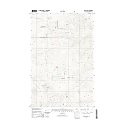
2014 Map of Duncan Ridge
USGS Topo · Published 2014About this map
The Okanogan National Forest dominates this landscape, where the confluence of several branches of Toats Coulee Road and Cecil Creek Road serve as the primary transport corridors through high-elevation terrain. Sparse human habitation is marked by seasonal outposts and functional sites, such as the Duncan James Cabin and the Skull and Crossbones Cabin, which sit in the shadows of the prominent Duncan Ridge and the unusually named Skull and Crossbones Ridge.
Find a feature on this map
37 named features on this map. Tap any name to fly to it.
Don’t see what you’re looking for? This feature index may not catch every label — zoom into the map to look around manually.
Map Details
Editions of this 2014 Duncan Ridge Map
This is the sole edition of this map. No revisions or reprints were ever made.
Other maps of this area

1906 · Chopaka
USGS Topo · 1:125,000

1954 · Okanogan
USGS Topo · 1:250,000

1956 · Loomis
USGS Topo · 1:62,500

1956 · Tiffany Mountain
USGS Topo · 1:62,500

1956 · Horseshoe Basin
USGS Topo · 1:62,500

1957 · Conconully
USGS Topo · 1:62,500

1958 · Okanogan
USGS Topo · 1:250,000
1980 · Blue Goat Mtn
USGS Topo · 1:24,000
1981 · Corral Butte
USGS Topo · 1:24,000
1981 · Horseshoe Basin
USGS Topo · 1:24,000