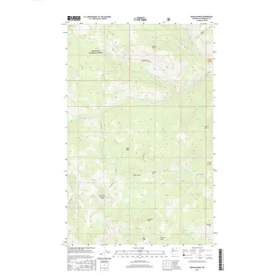
2017 Map of Duncan Ridge
USGS Topo · Published 2017About this map
The Okanogan National Forest in Washington State's high country is defined here by a network of steep ridgelines and deep drainage basins. High peaks like Tillman Mtn and Douglas Mtn anchor the landscape, while the curiously named Skull and Crossbones Ridge rises above the lower reaches of Cecil Cr. This terrain is intersected by historic timber and access routes, including Toats Coulee Rd and Cecile Creek Rd, which follow the natural contours of the mountain passes.
Find a feature on this map
32 named features on this map. Tap any name to fly to it.
Don’t see what you’re looking for? This feature index may not catch every label — zoom into the map to look around manually.
Map Details
Editions of this 2017 Duncan Ridge Map
This is the sole edition of this map. No revisions or reprints were ever made.
Other maps of this area

1906 · Chopaka
USGS Topo · 1:125,000

1954 · Okanogan
USGS Topo · 1:250,000

1956 · Loomis
USGS Topo · 1:62,500

1956 · Tiffany Mountain
USGS Topo · 1:62,500

1956 · Horseshoe Basin
USGS Topo · 1:62,500

1957 · Conconully
USGS Topo · 1:62,500

1958 · Okanogan
USGS Topo · 1:250,000
1980 · Blue Goat Mtn
USGS Topo · 1:24,000
1981 · Corral Butte
USGS Topo · 1:24,000
1981 · Horseshoe Basin
USGS Topo · 1:24,000