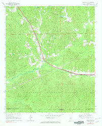
1969 Map of Duncanville
USGS Topo · Published 1972About this map
Duncanville sits at the junction of the Mobile and Ohio railroad and a network of creeks that define this portion of the Tuscaloosa County landscape. The southern half of the area is dominated by the Talladega National Forest, where the Shiloh Lookout Tower once stood as a sentry over the dense woodlands. The terrain is deeply etched by water, with Big Sandy Creek and Little Sandy Creek carving through the hills alongside family-named landmarks like Pattons Lake and Matthews Lake. For genealogists, the map preserves the exact locations of rural community centers, including Mt Olive Ch and Mt Zion Ch, along with their associated cemeteries. These sites, such as the South Sandy Cem, represent the enduring footprint of early settlements within the timbered valleys and along the old Freeman Line Road.
Find a feature on this map
34 named features on this map. Tap any name to fly to it.
Don’t see what you’re looking for? This feature index may not catch every label — zoom into the map to look around manually.
Map Details
Editions of this 1969 Duncanville Map
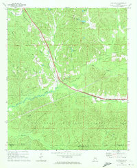
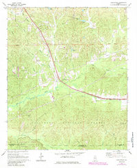
Other maps of this area

1899 · Brookwood
USGS Topo · 1:125,000

1924 · Tuscaloosa
USGS Topo · 1:62,500

1926 · Tuscaloosa
USGS Topo · 1:62,500

1931 · Cottondale
USGS Topo · 1:48,000

1934 · Cottondale
USGS Topo · 1:62,500

1953 · Montgomery
USGS Topo · 1:250,000

1953 · Birmingham
USGS Topo · 1:250,000

1956 · Birmingham
USGS Topo · 1:250,000

1956 · Montgomery
USGS Topo · 1:250,000

1957 · Birmingham
USGS Topo · 1:250,000