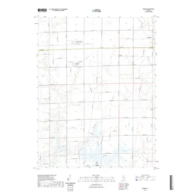
2021 Map of Dundas
USGS Topo · Published 2021About this map
Olney anchors the southern portion of this landscape, where the northern residential and commercial edges of the city meet the shores of East Fork Lake. Moving northward through Richland County into Jasper County, the terrain is defined by a systematic grid of rural roads and established agricultural tracts. The small community of Dundas serves as a central hub, while the Fox River and its various tributaries, including Long Br and Jack Oak Cr, provide drainage across the prairie. This area is dotted with numerous small cemeteries such as Saint Pauls Lutheran Cem and McBurg Cem, which suggest long-standing family settlements and local congregations. To the east, Raeftown and Stringtown Cem mark further localized nodes of community life along the border between the two counties.
Find a feature on this map
79 named features on this map. Tap any name to fly to it.
Don’t see what you’re looking for? This feature index may not catch every label — zoom into the map to look around manually.
Map Details
Editions of this 2021 Dundas Map
This is the sole edition of this map. No revisions or reprints were ever made.
Other maps of this area

1910 · Hardinville
USGS Topo · 1:62,500

1911 · Sumner
USGS Topo · 1:62,500

1913 · Sumner
USGS Topo · 1:62,500

1941 · Newton
USGS Topo · 1:62,500

1943 · Newton
USGS Topo · 1:62,500

1949 · Olney
USGS Topo · 1:62,500

1956 · Vincennes
USGS Topo · 1:250,000

1957 · Vincennes
USGS Topo · 1:250,000

1958 · Vincennes
USGS Topo · 1:250,000

1958 · Belleville
USGS Topo · 1:250,000