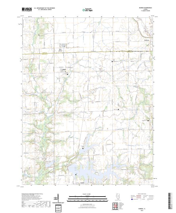
2024 Map of Dundas
USGS Topo · Published 2024About this map
The boundary between Jasper and Richland counties defines the upper third of this Illinois landscape, where the West Liberty and Dundas communities sit amidst a network of rural county roads. The terrain is deeply etched by a drainage system flowing southward, dominated by the Fox River and the winding Long Branch. This hydrology culminates in the southern portion of the map with the expansive East Fork Lake and the smaller, secluded Webber Lake. Numerous rural burial grounds are scattered throughout the countryside, providing significant points for genealogical study. These include the Saint Pauls Lutheran Cem near the center and the remote Stringtown Cem to the east. Small unincorporated clusters like Raeftown and McBurg appear along the northern and central corridors, while the presence of the Saron Cem and Bethel Cem indicates long-standing family and community ties to these specific sections of the Illinois interior.
Find a feature on this map
55 named features on this map. Tap any name to fly to it.
Don’t see what you’re looking for? This feature index may not catch every label — zoom into the map to look around manually.
Map Details
Editions of this 2024 Dundas Map
This is the sole edition of this map. No revisions or reprints were ever made.
Other maps of this area

1910 · Hardinville
USGS Topo · 1:62,500

1911 · Sumner
USGS Topo · 1:62,500

1913 · Sumner
USGS Topo · 1:62,500

1941 · Newton
USGS Topo · 1:62,500

1943 · Newton
USGS Topo · 1:62,500

1949 · Olney
USGS Topo · 1:62,500

1956 · Vincennes
USGS Topo · 1:250,000

1957 · Vincennes
USGS Topo · 1:250,000

1958 · Vincennes
USGS Topo · 1:250,000

1958 · Belleville
USGS Topo · 1:250,000