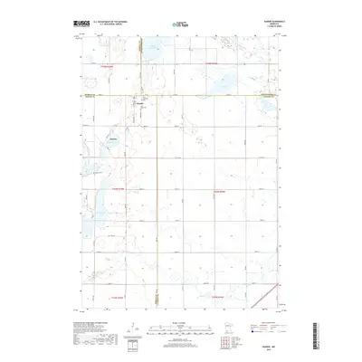
2019 Map of Dundee
USGS Topo · Published 2019About this map
Dundee sits at a critical junction of county lines in the southwestern Minnesota prairie, where the corners of Murray, Cottonwood, Jackson, and Nobles Counties converge. The landscape is defined by its glacial history, featuring a dense concentration of wetlands and water bodies such as Clear Lake, Jack Lake, and Kinbrae Lake. These lakes are connected by a network of drainage features like Judicial Ditch Number Twenty-six and Jack Cr, while the upper reaches of the Des Moines River flow through the northeast corner.
Find a feature on this map
64 named features on this map. Tap any name to fly to it.
Don’t see what you’re looking for? This feature index may not catch every label — zoom into the map to look around manually.
Map Details
Editions of this 2019 Dundee Map
This is the sole edition of this map. No revisions or reprints were ever made.
Other maps of this area

1954 · Fairmont
USGS Topo · 1:250,000

1958 · Fairmont
USGS Topo · 1:250,000

1960 · Brewster
USGS Topo · 1:24,000

1960 · Okabena
USGS Topo · 1:24,000

1960 · Worthington North
USGS Topo · 1:24,000

1970 · Heron Lake NW
USGS Topo · 1:24,000

1970 · Dundee
USGS Topo · 1:24,000
1970 · Heron Lake NE
USGS Topo · 1:24,000

1970 · Fulda
USGS Topo · 1:24,000
1970 · Lime Creek
USGS Topo · 1:24,000