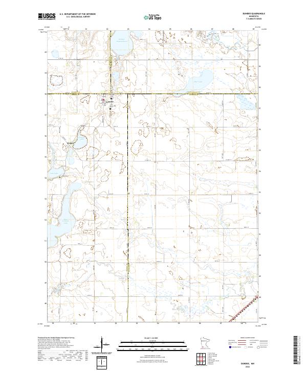
2022 Map of Dundee
USGS Topo · Published 2022About this map
Dundee sits at the junction of four counties in this southwestern Minnesota landscape, where the prairie is defined by an extensive network of lakes and water management features. The settlement is anchored by local history markers including the Lutheran Cem and Saint Marys Cem, while the surrounding township is organized by a rigid grid of agricultural roads such as Voss Ave and Wigwam Ave. Water dominates the eastern and northern reaches, from the winding Des Moines River and its accompanying Des Moines River Trl to large bodies like Clear Lake and the Wildlife Impoundment. Significant drainage projects, represented by Judicial Ditch Number Twenty-six, illustrate the region's long-term efforts to manage the wetlands between Kinbrae Lake and East Graham Lake. This map captures a highly structured rural environment where natural lakes like Jack Lake exist alongside the engineered landscape of the modern farm belt.
Find a feature on this map
62 named features on this map. Tap any name to fly to it.
Don’t see what you’re looking for? This feature index may not catch every label — zoom into the map to look around manually.
Map Details
Editions of this 2022 Dundee Map
This is the sole edition of this map. No revisions or reprints were ever made.
Other maps of this area

1954 · Fairmont
USGS Topo · 1:250,000

1958 · Fairmont
USGS Topo · 1:250,000

1960 · Brewster
USGS Topo · 1:24,000

1960 · Okabena
USGS Topo · 1:24,000

1960 · Worthington North
USGS Topo · 1:24,000

1970 · Heron Lake NW
USGS Topo · 1:24,000

1970 · Dundee
USGS Topo · 1:24,000
1970 · Heron Lake NE
USGS Topo · 1:24,000

1970 · Fulda
USGS Topo · 1:24,000
1970 · Lime Creek
USGS Topo · 1:24,000