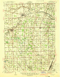
1941 Map of Dundee
USGS Topo · Published 1941About this map
The Raisin River carves a winding path through this corner of Monroe County, anchoring a landscape defined by its agricultural character and extensive rail network just before the mid-century. The Ann Arbor Railroad and New York Central Railroad intersect the region, connecting established villages like Dundee and Petersburg. These hubs served a dense network of rural schoolhouses, such as Egypt Sch and Raisinville Sch, many of which were still active centers of community life when this topography was recorded.
Find a feature on this map
188 named features on this map. Tap any name to fly to it.
Don’t see what you’re looking for? This feature index may not catch every label — zoom into the map to look around manually.
Map Details
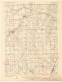
Editions of this 1941 Dundee Map
2 editions found
Other maps of this area

1900 · Maumee Bay
USGS Topo · 1:62,500

1900 · Toledo
USGS Topo · 1:62,500

1902 · Ypsilanti
USGS Topo · 1:62,500

1904 · Ann Arbor
USGS Topo · 1:125,000

1906 · Ypsilanti
USGS Topo · 1:62,500

1906 · Saline
USGS Topo · 1:62,500

1906 · Romulus
USGS Topo · 1:62,500

1908 · Ann Arbor
USGS Topo · 1:125,000

1911 · Swanton
USGS Topo · 1:62,500

1912 · Monroe
USGS Topo · 1:62,500
Featured Places
- Bedford Township, MI
- Lambertville, Bedford Township
- Temperance, Bedford Township
- Raisinville Township, MI
- Ida, Ida Township