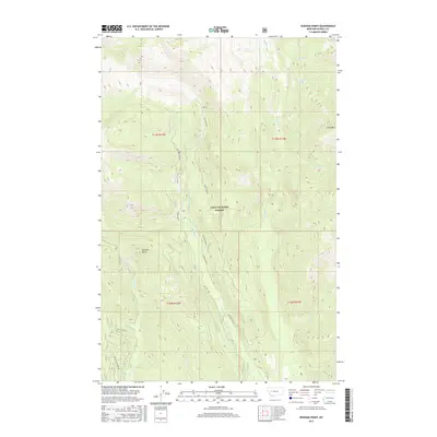
2017 Map of Dunham Point
USGS Topo · Published 2017About this map
Lolo National Forest encompasses the high mountain drainage basins of Powell County, where the peak of Fenn Mtn and the prominence of Dunham Point overlook a complex network of creeks and forest service routes. This 2017 survey shows the intricate hydrography of the region, defined by major watercourses such as Monture Cr and Dunham Creek, which are fed by smaller tributaries like Burnt Cabin Cr and Wedge Cr. The landscape is primarily organized around high points like Center Ridge and the connectivity provided by backcountry roads. Forest access is detailed through named routes including Dunham Creek Rd, Dry Cottonwood Spr, and FDR W Shanley. These roads follow the natural contours of the valley floors, providing vital links for modern land management and recreation within the expansive wilderness of the national forest system.
Find a feature on this map
27 named features on this map. Tap any name to fly to it.
Don’t see what you’re looking for? This feature index may not catch every label — zoom into the map to look around manually.
Map Details
Editions of this 2017 Dunham Point Map
This is the sole edition of this map. No revisions or reprints were ever made.
Other maps of this area

1902 · Ovando
USGS Topo · 1:125,000

1905 · Ovando
USGS Topo · 1:125,000

1955 · Choteau
USGS Topo · 1:250,000

1957 · Choteau
USGS Topo · 1:250,000

1958 · Choteau
USGS Topo · 1:250,000

1962 · Choteau
USGS Topo · 1:250,000
1965 · Woodworth
USGS Topo · 1:24,000

1965 · Morrell Mountain
USGS Topo · 1:24,000

1968 · Spread Mountain
USGS Topo · 1:24,000

1968 · Dunham Point
USGS Topo · 1:24,000