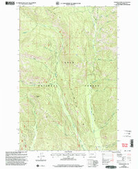
1999 Map of Dunham Point
USGS Topo · Published 2003About this map
Lolo National Forest encompasses the high country of Powell County in this late 20th-century survey, defined by a complex network of drainages and early forest management infrastructure. The Monture Guard Sta and the site at Burnt Cabin serve as historical anchors for the administrative and recreational use of the land. High peaks like Dunham Point overlook a landscape carved by Lodgepole Creek and Monture Creek.
Find a feature on this map
28 named features on this map. Tap any name to fly to it.
Don’t see what you’re looking for? This feature index may not catch every label — zoom into the map to look around manually.
Map Details
Editions of this 1999 Dunham Point Map
This is the sole edition of this map. No revisions or reprints were ever made.
Other maps of this area

1902 · Ovando
USGS Topo · 1:125,000

1905 · Ovando
USGS Topo · 1:125,000

1955 · Choteau
USGS Topo · 1:250,000

1957 · Choteau
USGS Topo · 1:250,000

1958 · Choteau
USGS Topo · 1:250,000

1962 · Choteau
USGS Topo · 1:250,000
1965 · Woodworth
USGS Topo · 1:24,000

1965 · Morrell Mountain
USGS Topo · 1:24,000

1968 · Spread Mountain
USGS Topo · 1:24,000

1968 · Dunham Point
USGS Topo · 1:24,000