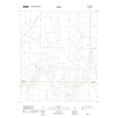
2019 Map of Dunn
USGS Topo · Published 2019About this map
The Colorado River meanders across the southern portion of this landscape, forming the county line between Scurry Co and Mitchell Co. In this part of the West Texas plains, the rural settlements of Ira and Dunn serve as local anchors connected by a network of farm roads and county routes. The topography is defined by the gradual transition from the uplands of Cherokee Ridge down into a complex drainage system. Tributaries such as Deep Creek, Sulphur Creek, and Canyon Creek carve subtle relief into the terrain, illustrating the hydrologic patterns that influenced early settlement and road placement. The map reveals a highly structured grid of land divisions, with routes like Block Line Rd and Round Top Rd following established survey lines through the ranching and agricultural country of the late 2010s.
Find a feature on this map
38 named features on this map. Tap any name to fly to it.
Don’t see what you’re looking for? This feature index may not catch every label — zoom into the map to look around manually.
Map Details
Editions of this 2019 Dunn Map
This is the sole edition of this map. No revisions or reprints were ever made.
Other maps of this area

1950 · Cedar Bend
USGS Topo · 1:24,000

1951 · Ira
USGS Topo · 1:24,000

1951 · Dunn
USGS Topo · 1:24,000

1952 · Cuthbert
USGS Topo · 1:24,000

1952 · Snyder
USGS Topo · 1:24,000

1952 · China Grove
USGS Topo · 1:24,000

1952 · Colorado City
USGS Topo · 1:24,000

1952 · Ira NE
USGS Topo · 1:24,000

1952 · Hermleigh
USGS Topo · 1:24,000

1954 · Big Spring
USGS Topo · 1:250,000