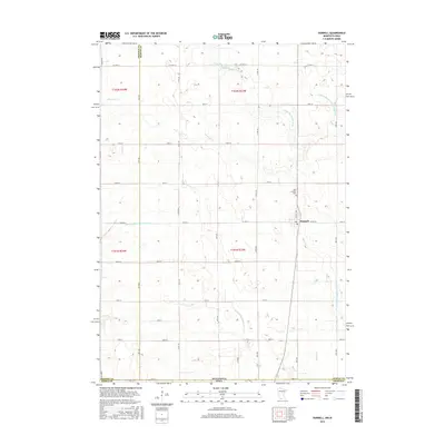
2016 Map of Dunnell
USGS Topo · Published 2016About this map
Dunnell stands as the central settlement in this agricultural landscape straddling the Minnesota-Iowa state line. Situated at the junction of Co Hwy 8 and N Seeley Ave, the town is surrounded by a complex network of managed waterways that define the local drainage patterns. To the north, Lake Fremont Cem overlooks the surrounding fields, while the E Fork Des Moines River cuts through the northeast corner of the quadrangle.
Find a feature on this map
79 named features on this map. Tap any name to fly to it.
Don’t see what you’re looking for? This feature index may not catch every label — zoom into the map to look around manually.
Map Details
Editions of this 2016 Dunnell Map
This is the sole edition of this map. No revisions or reprints were ever made.
Other maps of this area

1954 · Fairmont
USGS Topo · 1:250,000

1958 · Fairmont
USGS Topo · 1:250,000

1970 · Jackson NW
USGS Topo · 1:24,000

1970 · Ceylon
USGS Topo · 1:24,000

1970 · Jackson
USGS Topo · 1:24,000

1970 · Dunnell
USGS Topo · 1:24,000

1970 · Sherburn
USGS Topo · 1:24,000
1970 · Alpha
USGS Topo · 1:24,000

1972 · Estherville
USGS Topo · 1:24,000
1972 · Superior
USGS Topo · 1:24,000