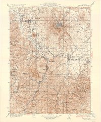
1935 Map of Dunsmuir
USGS Topo · Published 1935About this map
Dunsmuir and the industrial corridors of the Sacramento River dominate this mid-1930s survey of the northern California highlands. The Southern Pacific railroad is the primary artery of the region, linking the timber and transportation hubs of Weed and Mc Cloud to the river canyon. This era shows the landscape before modern interstate development, with the Sacramento Highway winding through the mountains alongside numerous small rail stops and post offices like Hazel Creek P O and Sims Sta.
Find a feature on this map
158 named features on this map. Tap any name to fly to it.
Don’t see what you’re looking for? This feature index may not catch every label — zoom into the map to look around manually.
Map Details
Editions of this 1935 Dunsmuir Map
4 editions found

Other maps of this area

1886 · Lassen Peak
USGS Topo · 1:250,000

1886 · Modoc Lava Bed
USGS Topo · 1:250,000

1886 · Shasta
USGS Topo · 1:250,000

1890 · Red Bluff
USGS Topo · 1:250,000

1892 · Modoc Lava-Bed
USGS Topo · 1:250,000

1892 · Lassen Peak
USGS Topo · 1:250,000

1894 · Lassen Peak
USGS Topo · 1:250,000

1894 · Red Bluff
USGS Topo · 1:250,000

1894 · Shasta
USGS Topo · 1:250,000

1901 · Redding
USGS Topo · 1:125,000