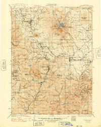
1935 Map of Dunsmuir
USGS Topo · Published 1948About this map
The glacial and volcanic mass of Mt Shasta dominates this 1930s survey, surrounded by the industrial and recreational development of the Upper Sacramento River canyon. The Southern Pacific railroad follows the river's path, connecting timber and transit hubs like Weed and Dunsmuir. The landscape reflects a transition from the heavy industry of logging and railroading to early 20th-century tourism, evidenced by Shasta Springs and the McCloud River Club.
Find a feature on this map
176 named features on this map. Tap any name to fly to it.
Don’t see what you’re looking for? This feature index may not catch every label — zoom into the map to look around manually.
Map Details
Editions of this 1935 Dunsmuir Map
4 editions found

Other maps of this area

1886 · Lassen Peak
USGS Topo · 1:250,000

1886 · Modoc Lava Bed
USGS Topo · 1:250,000

1886 · Shasta
USGS Topo · 1:250,000

1890 · Red Bluff
USGS Topo · 1:250,000

1892 · Modoc Lava-Bed
USGS Topo · 1:250,000

1892 · Lassen Peak
USGS Topo · 1:250,000

1894 · Lassen Peak
USGS Topo · 1:250,000

1894 · Red Bluff
USGS Topo · 1:250,000

1894 · Shasta
USGS Topo · 1:250,000

1901 · Redding
USGS Topo · 1:125,000